Decree Promulgating Parish Boundaries
Whereas throughout the world the Latin Church, in accord with ancient Roman law, is divided into territorial areas which are governed by a diocesan bishop or an equivalent in law (Code of Canon Law, canon 372 §1);
Whereas dioceses too are divided into distinct parts called “parishes,” which are ordinarily territorial in nature (canons 374 §1; 518);
Whereas the territorial boundaries of parishes in the Diocese of Honolulu have not been examined in some decades;
Whereas many factors related to population changes and growth have taken place during the course of those years, making the reexamination of boundaries apropos at this time;
Having consulted the Presbyteral Council in accord with canon 515 §2, I hereby define the canonical boundaries of all parishes of the diocese in accord with this attached Parish Map Book and current link https://www.hhf.com/parish-boundary (password is “parish”), which form an integral part of this decree.
These boundaries take effect on January 1, 2026.
Given at the Office of the Bishop in Honolulu, Hawaii, on the first day of December, 2025.
Most Reverend Clarence Silva, Bishop of Honolulu
Dcn. Keith Cabiles, Chancellor
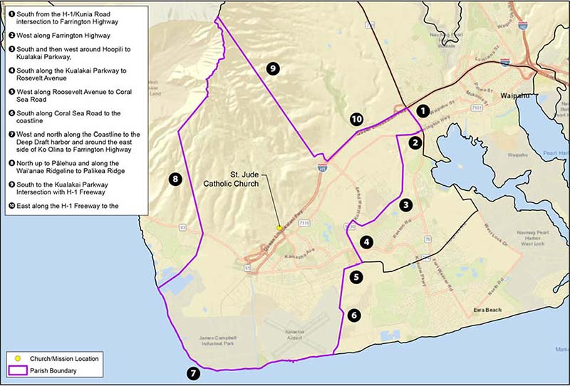
St. Jude Church, Kapolei
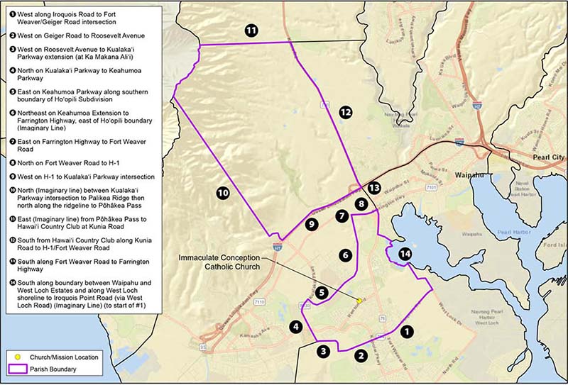
Immaculate Conception Church, Ewa
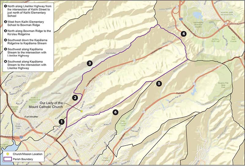
Our Lady of the Mount Church, Kalihi
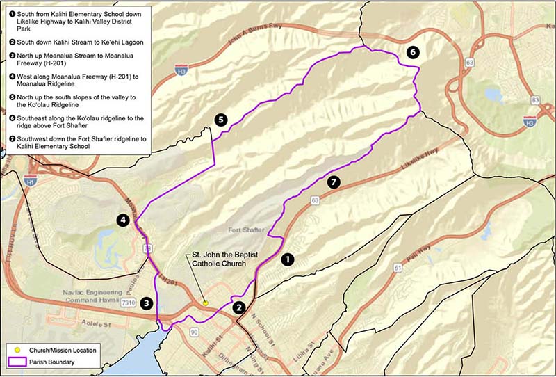
St. John the Baptist Church, Kalihi
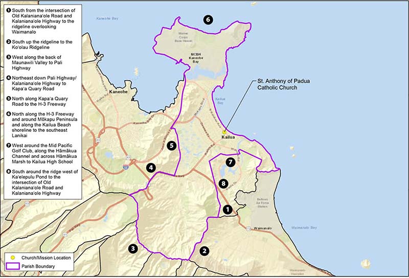
St. Anthony of Padua Church, Kailua
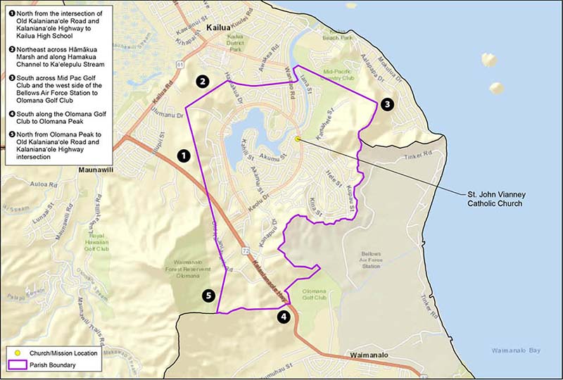
St. John Vianney Church, Kailua
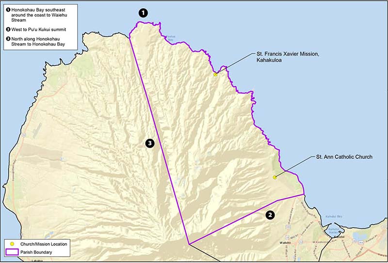
St. Ann Church, Waihee
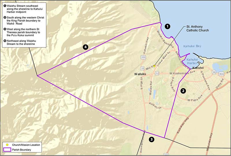
St. Anthony of Padua Church, Wailuku
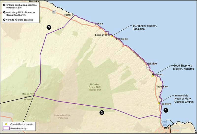
Immaculate Heart of Mary Church, Papaikou
The boundary maps can be found in the “Catholic Church in Hawaii Parish Map Book, August 2025,” published by the Diocese of Honolulu.
The sources for the maps are: Esri, U.S. Geological Survey Maxar, Earthstar Geographics and the GIS User Community.